|
 |
|
|
 |
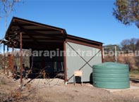
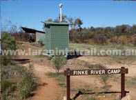
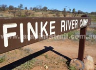
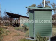
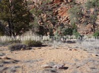
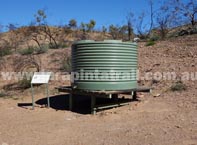
 Finke River Campsite (Trailhead) Finke River Campsite (Trailhead) |
|
 |
 |
|
| Broad view of trailhead area |
|
 |
 |
|
| Toilet and trailhead in background |
|
|
| Designation |
Designated (official) campsite |
| Campsite Facilities |
        |
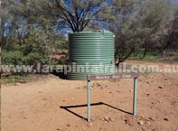
| Water |
Yes- Tanks |
Capacity  located at campground. Size used to determine capacity is an average 2 person sized tent. NOTE: These figures and descriptions are guides only and may gradually change. Accurate as at July 2013") |
3-4 tents |
| Camping Fees |
Apply |
| Campsite Access |
Trail Access Only. |
| Maps & GPS Data |
Shown on Trail Maps  |
| Restrictions |
Strictly No Campfires or Open Fires |
|
 Snapshot Description Snapshot Description |
|
 |
Newish trailhead shelter, elevated tent pads and toilets. |
|
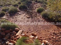
Finke River offers some soft sandy camping options |
|
Two big water tanks |
|
Scenery around the area is a little boring. Finke River is nearby. |
|
| Links & Additional Info |
|
.S11 Trailhead - Finke River  | Section 11 | Section 11 |
|
|
|
| Hill Top Lookout Campsite |
|
 |
 |
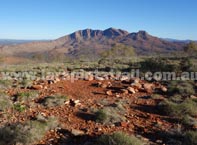
| Tend pad. Mt Sonder in background |
|
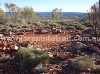
| Tend pad with surrounding rock |
|
 |
 |
| Tend pad with views to the south. |
|
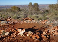
| Tend pad. Tight fit amongst spinifex. |
|
|
| Designation |
Designated (official) campsite |
| Campsite Facilities |
Tent pads only |
| Water |
None |
| Capacity |
3-4 tents |
| Camping Fees |
Apply |
| Campsite Access |
Trail Access Only. |
| Maps & GPS Data |
Shown on Trail Maps |
| Restrictions |
Strictly No Campfires or Open Fires |
|
| Snapshot Description |
|
|
Excellent views of Mount Sonder, especially on sunrise. Must see. |
|
Very rocky area and can be windy during the nights. Lots of spinifex. |
|
Great surrounding views of the area |
|
Tent pads are solid ground - hard. |
|
| Links & Additional Info |
|
| Section 11 |
|
|
|
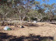
| Rocky Bar Gap Campsite |
|
 |
 |
| Campsite signage with water tank |
|
| Campsite area and tent pads |
|
 |
 |
| Northern campsite area/tent pads. |
|
| Northern campsite tent pad |
|
|
| Designation |
Designated (official) campsite |
| Campsite Facilities |
Toilets at southern end |
| Water |
Yes- Tank ( at southern end) |
| Capacity |
Open Area |
| Camping Fees |
Apply |
| Campsite Access |
Trail Access Only. |
| Maps & GPS Data |
Shown on Trail Maps |
| Restrictions |
Strictly No Campfires or Open Fires |
|
| Snapshot Description |
|
|
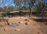
Main campsite is located at southern end where water tank/ toilet is. |
|
Southern campsite is a little bare and open, can be dusty. |
|
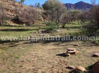
Northern campsite is much more comfortable and scenic. |
|
Northern campsite is the most popular. |
|
| Links & Additional Info |
|
| .Section 11 |
|
|
|
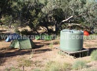
| Redbank Campsite (Trailhead Area) |
|
 |
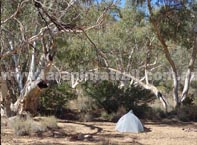 |
| Campsite area at the creek |
|
| Tent pads along creek beds |
|
 |
 |
| Campsite area at the water tank area |
|
|
|
| Designation |
Designated (official) campsite |
| Main Area Facilities |
  |
| Campsite Facilities |
|
| Water |
Yes- Tank |
| Capacity |
Open Area |
| Camping Fees |
Apply |
| Campsite Access |
AWD/4WD. Dirt road. See below. |
| Maps & GPS Data |
Shown on Trail Maps |
| Restrictions |
Strictly No Campfires or Open Fires |
|
| Snapshot Description |
|
|
Some good camping spots along the creek which offer some shade |
|
Campsite ground is sandy creek soil, comfy and soft. |
|
The campsite area near the tank is solid earth ground, hard and bare |
|
Trailhead is located about 200m from campsite at main visitor area |
|
| Links & Additional Info |
|
| S12 Trailhead - Redbank Gorge | Section 11 |
|
|
| |
| |
|
|
 |
|