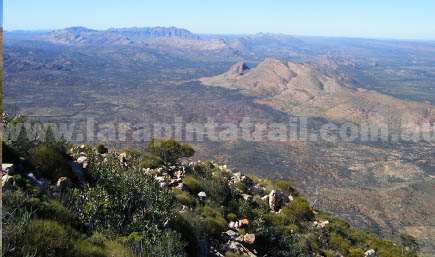
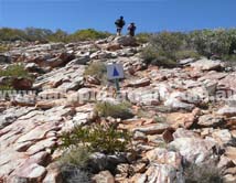
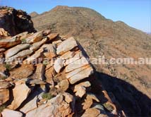
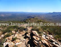
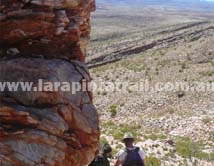
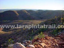
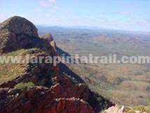
| Section 12 is an uphill walk the whole way to Mt Sonder. Expect a good physical workout even during the descent off the mountain. The trail is a rocky, loose and occasionally a disappearing track (from the Saddle onwards). The views from the summit are superb and well worth the effort of the climb. No camping at the Mount Sonder summit. |
| |
 Snapshot Snapshot |
|
 |
Uphill climb the whole way |
|
No Camping on Mount Sonder |
|
One of the Larapinta Trails best hikes |
|
Very little shade the whole way |
|
| Highlights |
|
|
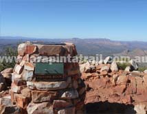
Mount Sonder summit |
|
Exceptional 360 degree views most of the way up/down |
|
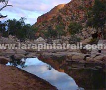
Redbank Gorge ( especially when the waterhole is full) |
|
Excellent way to start the End2End |
|
 Related Links Related Links |
|
|
|
 |
|
| |
| Trail Grade |
 |
Hard:Fit & experienced walkers only |
| Distance (km) |
15.8 |
|
| Duration (hrs) |
6 |
Comfortable. Allow Sightseeing |
| Terrain |
Rough |
Very Rocky, Loose. |
| Gradient |
Uphill |
Uphill. Steep in some places. |
| Trail |
Poor |
Poorly defined. |
| Water |
Yes |
Limited. In tanks only. |
| Shade |
V Limited |
Very open country. High UV |
| Camping Fees |
Yes |
Redbank Gorge ($5.00 per person) |
| Campsites |
Yes |
S12 Campsites page  |
| Walk Options |
Yes |
Day |
|
|
|
|
| Redbank Car Park |
       |
| Redbank Campsite |
  |
|
|
|
|
|
|
|
|
|
|
|
 |
S12 Webpage  Coming Soon Coming Soon |
|
NT Parks Section Fact Sheet and Trail Map  |
|
NT Parks Section Fact Sheet and Trail Map |
|
|
|
|
") Getting to Redbank Gorge Trailhead Getting to Redbank Gorge Trailhead |
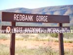 |
The Redbank Gorge Trailhead is approx 156km west of Alice Springs and can be accessed via the sealed Larapinta & Namatjira Drives to the Redbank Gorge track turn off. From the T/O to the Redbank Gorge Day Use Area is a slightly rough 5km gravel track suitable for AWD/4WD vehicles only. |
|
| |
|
 Connected Walks & Trails Connected Walks & Trails |
| Redbank Gorge Walk |
|
|
 Off Track Off Track |
| None |
|
|

