|
 |
|
|
|
 |
 |
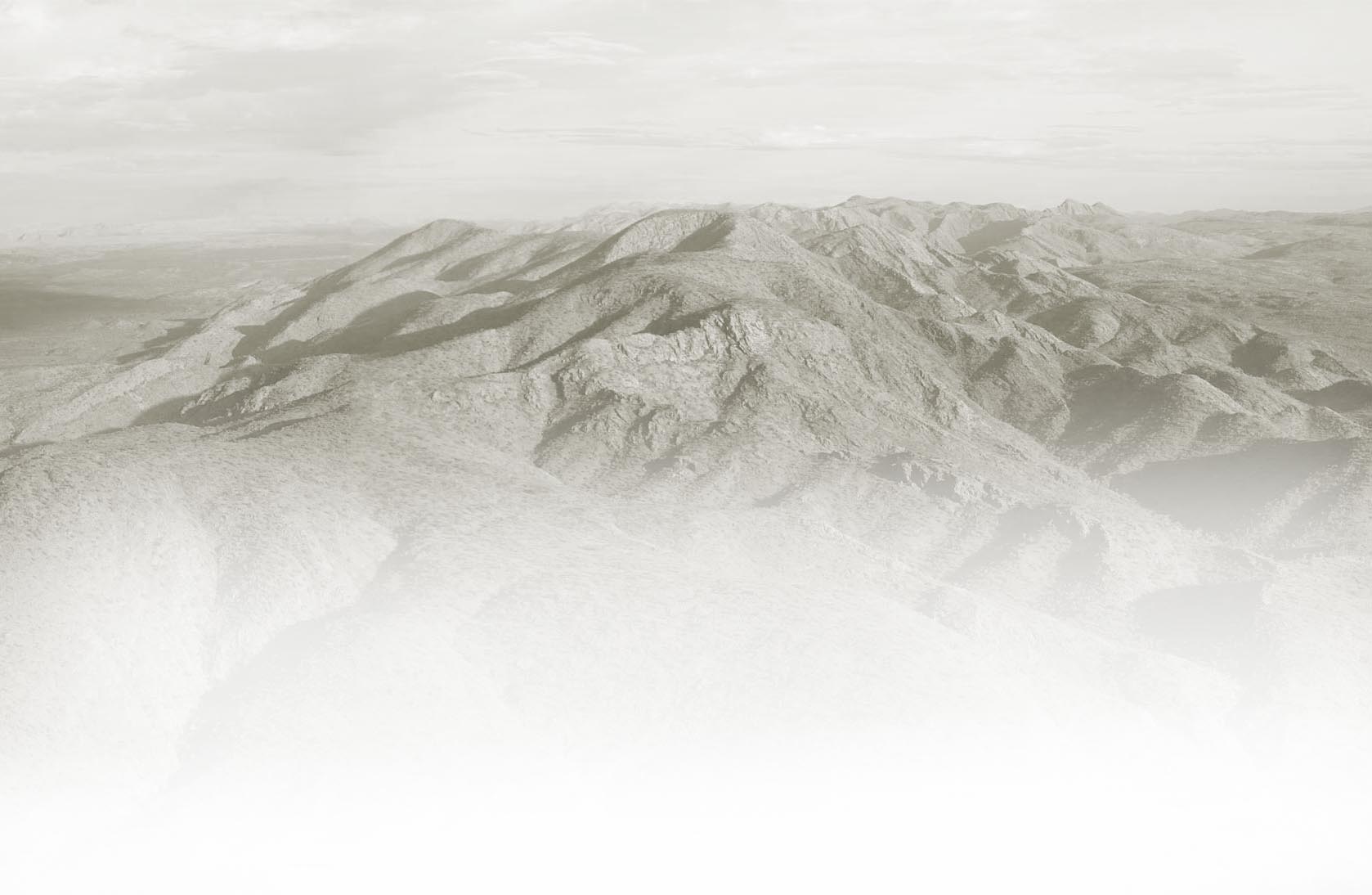
| The trail conditions of the Larapinta Trail are
rocky, rugged, hard surfaced
and dry.
While a number of sections of the trail wind through open plains, undulating areas and
relatively flat country, overall, the trail is characterised by
rocky, stony and mountainous terrain which can rise from 680m above
sea level to more than 1,200m along some sections. |
|
 Key Points Key Points |
|
 |
Majority of the trail is along mountain country |
|
Most of the trail is rocky & rough |
|
Trail is hard on feet ( and boots) |
|
Track conditions vary. See below. Trail definition is mostly good. |
|
There is limited shade and vegetation |
|
Some sections reach 1,000m above sea level |
|
Some of the trail is undulating and easy going |
|
Vegetation is often prickly, scrubby or harsh, or a combo of all these |
|
|
 |
|
 |
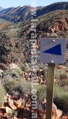
| Trail definition along the Larapinta Trail is mostly OK ( see examples to the right). The trail is reasonably clear, identifiable and obvious to follow. However there are a number of points along the trail which have poor or no definition at all. Examples include some rocky high ground areas and gorges where there is no physical 'trail' - just a jumble of rocks and boulders. Trail variations (see below) generally dictate the trail definition quality a hiker can expect. Overall the average width of the Larapinta Trail is approx 1m. Read some useful key points below. |
| Key Points |
|
|
Trail definition is best on Flat Plain/Low Lying areas ( See below) |
|
Trail definition is poorest on high ground & in gorges( See below) |
|
Poor trail definition can extend up to 800m-1km lengths at a time |
|
No trail definition can extend for hundreds of meters at a time |
|
Soil compaction & footprints are best indicators in poorly defined areas |
|
Average width of the trail is approx 1m and no shoulder clearance |
|
 Blog Links Blog Links |
|
|
|
 |
|
|
|
|
| Snapshot |
|
| Snapshot |
|
| Trail conditions defines the physical conditions of the trail and how they will affect you, your pace, your equipment and overall experience. The Larapinta Trail is mostly rocky, hilly, mountainous and in many areas, rough. Conditions vary depending on the variation (see right) of the trail but overall most walkers can maintain an average pace of approx 4-5km/h. Don't expect a well cleared and graded trail because most of the Larapinta Trail is not neatly cleared ( of rocks etc) with a well defined path. Trail definition is pretty good, but its no footpath. |
|
| Trail variation is basically the type of landform or topography the actual trail passes over. Trail variations of the Larapinta Trail is diverse because it traverses over many different landforms such as large valleys, mountain ranges, gorges and open plains. Often a section will have a number of different trail variations. Trail definition will often change with each variation. For example the trail is poorly defined or non existent on high ground, narrow gorges and river/creek beds. Eight of the most common variations are listed below. |
|
| Key Points |
|
| Key Points |
|
|
Trail are mostly rocky, hilly, mountainous and in many areas, rough |
|
Average walking pace is approx 4-5km/h |
|
Have good fitting footwear. Boots/soles get a serious workout |
|
Some very steep sections ( 45 degree + ) |
|
Most of the Larapinta Trail is not neatly cleared with a well defined path. |
|
|
Diverse trail variations. A number of variations in each section. |
|
Mountainous country is common; includes very steep sections |
|
Open valleys of hilly and undulating country is also common |
|
Trail is poorly defined in some variations. Always look for compaction. |
|
Closed gorge country will often require clambering over boulders |
|
|
|
 |
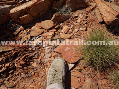
 Terrain Terrain |
|
| A majority of the terrain on the Larapinta Trail is rough and rocky, particularly on high ground, in gorges, creek and river beds. The ground is often distorted with embedded or loose rock depending on the trail variation |
 Main Points Main Points |
|
|
Have good fitting footwear - essential |
|
Strap weak ankles and knees |
|
Watch your step - loose ground |
|
Tape up sensitive blister points on feet |
|
Ground is often jagged & can be sharp |
|
Boots/soles get a serious workout |
|
| |
|
 |
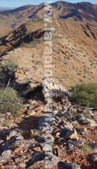
| Gradients |
|
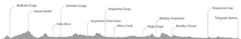
| The trail has a number of different gradients, most of which are between 11.5 (moderately steep) to 45 degree ( very steep) slopes. Gradients can significantly vary and change within sections. Check out the Trail Profile |
| Main Points |
|
|
Majority hilly and undulating gradients |
|
Some very steep sections ( 45 degree +) |
|
Gradients significantly vary in sections |
|
Few flat areas, mostly in S2, S10 |
|
Trail can reach elevations of 1,200m |
|
Average trail elevation is around 850m |
|
| |
|
 |
| Going |
|
| Most walkers can
complete individual sections within the suggested time frames despite the influences of rugged terrain, steep gradients and trail variations. Fitness, pack weights & timings will influence going |
| Main Points |
|
|
Average walking pace is approx 4-5km/h |
|
Trail is mostly well defined & easy to follow |
|
Few obstacles to slow you down |
|
Rough rocky ground is very slow going |
|
Slowest sections for going: S3, S4, S5, S12 |
|
Fastest sections for going: S10 |
|
| |
|
 |
| Obstacles |
|
| Most of the obstacles on this trail are deep pools or waterhole's, and at times river or creek crossings. It has to rain significantly for this to become a serious problem. There are no other major obstacles on this trail. |
| Main Points |
|
|
Very few serious obstacles along the trail |
|
Main obstacles are deep pools in gorges |
|
Always be prepared for wet crossings |
|
Other obstacles include boulders, creek slabs |
|
Thick river/creek debris can be difficult |
|
Bypassing deep pools via cliffs is tricky |
|
| |
|
 |
| Vegetation |
|
| Vegetation along
almost all of the Larapinta Trail is low lying, sparse and/or open.
Much of it is covered with spinifex and various small-medium sized trees and shrubs. Do not expect too much shade either. |
| Main Points |
|
|
Mostly open spinifex country |
|
Spinifex is needle sharp (& is everywhere) |
|
Open arid country, small stumpy trees/shrubs |
|
Most thickish vegetation is on low ground |
|
Virtually no shade on some high ground |
|
River Red Gums are common in low areas |
|
| |
|
| |
|
 |
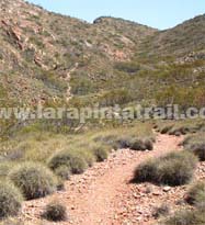 |
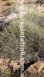
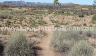
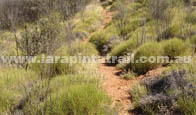
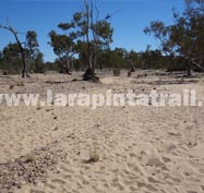
| Flat Plain/ Low Lying |
Open Valley |
| Parts of the trail like this offer relief from rocky and rough
terrain. The track is well defined and usually meanders its way
over mostly flat areas |
|
| This is a common sight in low lying valley areas - open country,
undulating or hilly, limited shade, well defined and well compacted trail definition. This variation is quite common on the Larapinta Trail |
|
| |
 |
 |
See Video or Images |
|
|
|
See Video or Images |
|
 |
 |
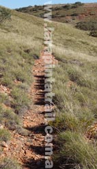
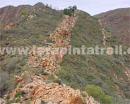
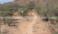
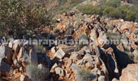
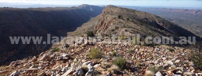
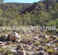
| Razorback Ridges |
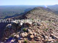
High Ground ( above 900m) |
| Razorbacks and other cliff edge sections are not very common, but they can be found along sections 4 & 5. Most are easy to negotiate but nevertheless do require caution. |
|
| Another
common view on almost all the high ground of the Larapinta Trail. Often, the trail cannot be clearly identified and many times, doesn't exist.
The image above is looking directly towards the 'trail'. |
|
|
|
See Video or Images |
|
|
|
See Video or Images |
|
 |
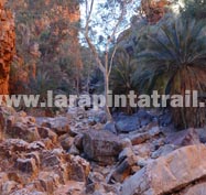 |
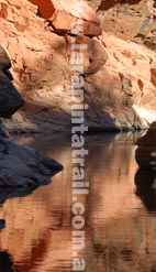
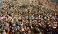
| Open Gorge |
Closed Gorge |
| Open gorge country is a little less rugged than closed gorge country, but often involves negotiating rocky, loose and uneven terrain which is sometimes coated with finely coated with slippery dry soil. Trail definition is poor or non existent. Look for trail compaction and signs. |
|
| Rough and rugged closed gorge country often narrow and involves precarious and
difficult clambering over boulders, large debris, rock ledges and slabby terrain. May also involve crossing deep pools. Trail definition is virtually non existent. Look for trail compaction and signs.. |
|
|
|
See Video or Images |
|
|
|
See Video or Images |
|
|
|
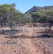
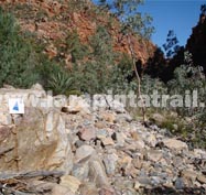
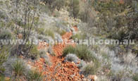
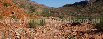
| Rocky River and Creek Beds |
Dry River and Creek Beds |
| This variation of the trail traverses over creeks and river beds, many of which are dry but are often rocky and rough. Some parts of the trail includes 3-5kms of walking along this type of terrain. Look for trail compaction and signs. Signs are usually nailed to trees at 6-10ft high |
|
| Crossing (often dry) but sandy creek and river beds are common along the trail. Most are short (less than 40m) in width, while some crossings are up to a 100-200m wide. Sand is coarse and soft. May involve wet crossings. Look for trail compaction and signs.. Lots of footprints often indicate the 'trail'. |
|
|
|
See Video or Images |
|
|
|
See Video or Images |
|
|
|
| |
|
 |
|