 |
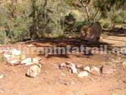
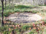
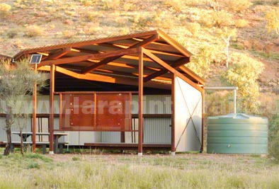
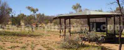
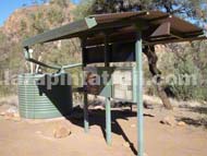
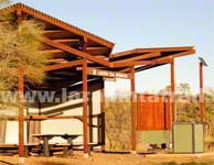
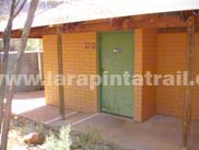
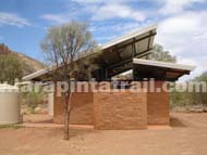
Most of the Larapinta Trail campsites  (not to be confused with the main national park campgrounds) are found at each trailhead or intermediate point. (not to be confused with the main national park campgrounds) are found at each trailhead or intermediate point. |
| The campsites are often poorly marked (there are no signs which clearly indicate where you can camp or put your tent). The most obvious campsite indicator is where walkers have cleared areas for their tents. Campsites can also be found in between trailhead and intermediate points such as Brinkley’s Bluff |
| |
| |
|
 |
|
 |
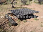 |
 Wooden Tent Pads Wooden Tent Pads |
| Wooden Tent Pads (pictured left) are found along many parts of the trail. Some are under sheltered areas, others are in the open. They are a solid wood construction about 3ft off the ground and wide enough to place a two-person tend on top of it. |
|
|
|
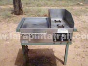
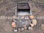
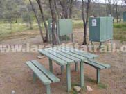
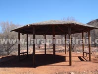
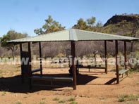
| There are a number of BBQ facilities but very few fire places around the national park and along the trail and ALL are in clearly designated areas.. |
 NOTE: Campfires are strictly prohibited the Larapinta Trail. NOTE: Campfires are strictly prohibited the Larapinta Trail. |
 Gas BBQ Gas BBQ |
 Open Fireplaces Open Fireplaces |
|
|
| Parks have provided free gas BBQ's at a number of locations along the trail. The gas BBQ's provide excellent alternative to using your own gas stoves (and plundering nearby natural resources for open fires). |
Open fires are restricted to only designated areas in the national park. Fires are NOT permitted anywhere else and NT Parks strictly prohibits hikers from having campfires on the Larapinta Trail. |
 |
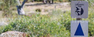 |
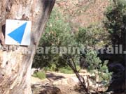
 Trail Markers Trail Markers |
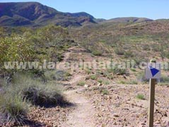 |
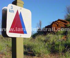
| The trail is marked by 100mm x 100mm square signs with a blue rectangular arrow on a white reflective background screwed to matt green steel posts . They are generally spaced every 1km, but in some sections, like Section 12 , they can often be between 200m-300m apart. Every so often a marker will have the total distance remaining on of the section. |
Larapinta Trail markers are normally placed on posts along the trail but are also nailed to trees ( normally at eye height or higher) or glued to rocks or boulders. With the exception of larger markers normally found nailed to the trees, all Larapinta Trail markers are the same size ( approx 100mm x 100mm). |
|
 |
 |
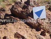 |
| Multiple Trail markers ( see image above left) which have both a blue and red triangle indicate linked trails (not part of the Larapinta Trail) leading off it. Some of these secondary or additional 'linked' trails include the magnificent Ormiston Pound Walk. |
| Other Trail Signage |
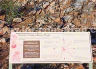 |
 Interpretation
(Interp) Boards Interpretation
(Interp) Boards |
| Interpretation (Interp) boards, large and small, are mostly concentrated around the main car park areas of Ormiston Gorge (S10), Ellery Creek (S6) and Simpson Gap (S2) . The interp boards provide fantastic illustrations with good information about flora, fauna, history and some do;'s and don't's. |
|
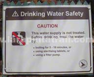 |
Advisory Boards |
| Advisory Boards have been placed along some sections of the trail to provide warnings, recommendations or instructions in sensitive, restricted or key areas concerning health and safety, cultural heritage or environmental protection. |
|
 |
Junction Signage |
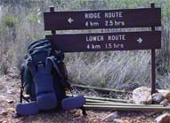
| Permanent signs have been placed at main junction areas, the most obvious junction point being at Section 3 (Tangentyere Junction and Millers Flat) where walkers can decide to take the higher or lower route option. |
|

|


