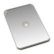
 Whistles Whistles |
|
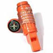
| When yelling for help fails or is no longer possible ( i.e. severe thirst, weakness etc) or you need something louder than your own voice, whistles provide an excellent alternative for close up signalling. Lightweight, cheap and easy to carry, they can be heard hundreds of meters away. Definitely worth carrying. |
 Personal Locator Beacon (PLB) Personal Locator Beacon (PLB) |
|
A PLB or Personal Locator Beacon ( a smaller version of the EPIRB) when activated sends a distress signal which is detectable by satellites or over flying aircraft. PLB's vary in capability, but generally should have a minimum 24-48 transmission period and be GPS enabled ( allowing exact position accuracy up to 100m). All PLB's must now be digital 406 MHz. |
Right Image Model Shown: ACR ResQLink+™ PLB |
 Satellite Messaging Devices Satellite Messaging Devices |
|
One of the most popular satellite messaging devices is the SPOT  device. This is a subscription based service which offers SOS emergency messaging, GPS tracking, custom messaging and other features. The tracking feature can also be viewed in near real time online. It is lightweight, easy to use and 100% satellite technology based. BUT it has drawbacks and is a poor alternative to a PLB. device. This is a subscription based service which offers SOS emergency messaging, GPS tracking, custom messaging and other features. The tracking feature can also be viewed in near real time online. It is lightweight, easy to use and 100% satellite technology based. BUT it has drawbacks and is a poor alternative to a PLB. |
 Strobe Lights Strobe Lights |
|
| Strobe lights are an excellent night signalling device because they can be seen up to 7-10km on a clear night. They are lightweight, robust and can work continuously for up to 8 hours. Always have a spare set of batteries. |
Right Image Model Shown: ACR Firefly®3 |
 Flashlight/Torch Flashlight/Torch |
|
| Obviously any type of torch or headlamp can be used at night for sending emergency signals. There are also powerful LED torches with up to 500.0 lumens available on the market today. Good LED torches generally cost between $150 to $200 depending on brand. |
 Lasers Lasers |
|
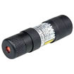
| Laser signaling
devices can be more effective than conventional torches but are also much more
expensive (about $170). A current lightweight product called the Rescue Laser
Flare is visible up to 30km at night and up to 6km in the day. They are compact, non flammable and non hazardous. |
 Cyalume
Sticks (Night) Cyalume
Sticks (Night) |
|
| Cyalume
sticks are a light weight handy piece of equipment. They are excellent for
marking locations of campsites, packs or people at night but are only visible to
the naked eye at night up to a kilometre away. Although they are a 'one off'
item, they are cheap - about $7-$10 each and a worth it. They come in various
colours which includes white, yellow, blue, red and orange. |
 Signal Mirrors (Day) Signal Mirrors (Day) |
|
| Most personal
signal mirrors are small, compact and sturdy. It is one of the most practical, basic and
best all-round signaling devices. It doesn't need batteries, but it does need the
user to have a bit of knowledge and skill in its use. In normal sunlight
conditions in Central Australia, mirrors can be seen up to 10 - 20km away and
much further from the air. |
 UHF/VHF/HF
Radio UHF/VHF/HF
Radio |
|
| UHF/VHF radio is not a practical communication choice for hiking. Radios are heavy, cumbersome, need to be re-charged and the mountainous terrain of the Larapinta Trail can make UHF/VHF communications difficult. VHF and HF radios need some technical and specialised knowledge to use effectively. |
 Bright
Clothing/Markers Bright
Clothing/Markers |
|
| Bright clothing, tents or panel markers (pictured)
in the open is one effective way of being seen, particularly in open terrain (and in daylight). If
you have no other signaling devices, spread what bright clothes or items ( i.e. sleeping bag, tents, markers) you have on the
ground to help authorities spot you, particularly from the air, or hang them in
tress for ground searches. |
 Flares Flares |
|
| Mini Flares |
| These generally come in
small packet of 8 individual flares, they are fired from a small handheld tool.
The flare has an approximate burning time of about 10-12 seconds and can go as
high as 70m-100m and visible up to 6-10km ( more at night). |
| Day Night
Flares |
|
| These flares are
very compact personal survival flares with a signal red flare at one end (for use
at night), and a dense orange smoke at the other (for daylight). They are
compact and easy to carry. Smoke burn time is approx 18 seconds, while flare burn
time is approx 20 seconds at 10,000 candlelight |
