Both Hugh Gorge Trailhead (S6) and 4/5 Junction Trailhead (S5) is accessible by vehicle, but ONLY by high clearance 4WD's. The track goes through dry river and creek beds and traverses over rocky terrain and badly eroded areas. In other parts of the track, the drive is easy going and comfortable. The drive is also very scenic. Access is all year round, weather permitting.
Main Points
Access from Alice Springs is via the Namatjira Drive (sealed)
From the Namatjira Dve Turn Off onwards the track is 4WD only
High clearance 4WD's is required.
Vehicle access all year. Weather permitting
Vehicle parking and camping allowed at 4/5 Junction
Vehicle parking and camping allowed at Hugh Gorge
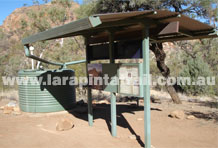
Trailheads and water tanks are the only facilities
Distances
Alice Springs - Turn Off via Namatjira Dve- Approx 56km
Namatjira Dve Turn off - 4/5 Junction: Approx 14.4km
Namatjira Dve Turn off - Hugh Gorge: Approx 22.3km
Blog Posts
Accessing Larapinta Trail Trailheads
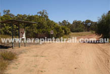
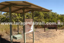
At the Turn Off ( Track/Namatjira Dve) looking north. There is small information area at the start of the track with some basic access information and maps of the route in. The image to the right is a close up of the information bay.
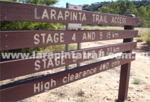
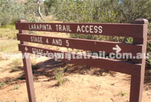
Basic signage at the start of the track showing distances and locations.
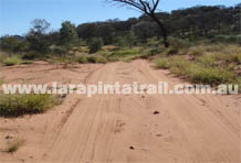
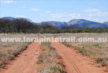
The first part of the track is along sandy terrain as shown, but gradually gets rocky.
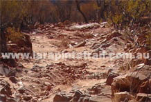
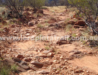
Rocky parts of the track. The image doesn't really represent the roughness. Only 1st gear ( low 4WD) slow speeds are possible, with lots of bouncing around.
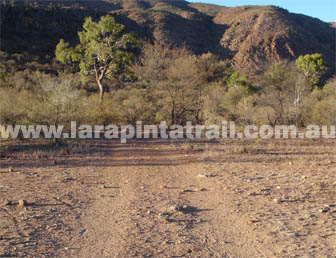
The junction point between 4/5 Junction Track and the Hugh Gorge Track.
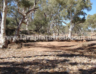
Track going through riverbeds. These sections can be soft at times but are no problem for 4WD's. During heavy rains, such sections would be impassable.
A great section of the Hugh Gorge Track part. A lot of the track toward Hugh Gorge is like this and is also very scenic. Closer to Hugh Gorge, the track turns rocky and rough again.
Rocky parts of the track. The image doesn't really represent the roughness. Only 1st gear slow speeds are possible, with lots of bouncing around. There are a number of sections like this which require traversing over rocks and boulders varying in sizes anywhere between a tennis ball to soccer ball size rocks.
Smooth sections like this are also very common. Solid ground, easy driving. This section is near 4/5 Junction area.
Creek and riverbed crossings are common. Unless there has been heavy rain, all creeks and rivers along this access route are dry ( but some are soft). There may be some chances of dry bogs. Some creeks and rivers require steep descents and ascents, using low four gears. If it rains heavily these creeks and rivers would be impassable
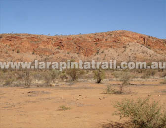
The access route passes through a lot of old cattle country, so it is common to cover areas of bare country with sections which are badly eroded through overgrazing and rain erosion of tracks.
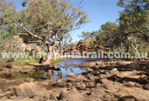
The trailhead at 4/5 Junction. The trailhead is not actually located in the gorge area of 4/5 Junction. The waterhole area is another couple of hundred meters away to the south.
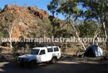
The campground and parking area at the 4/5 Junction gorge area. The campground is a very pleasant but narrow and small area. Tour groups and the general public use this area and at times can be 'crowded'.
4/5 Junction at its northern end looking south.When the waterhole is full, the area is a small oasis.
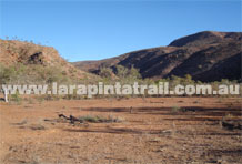
The junction point between Section 4 and 5. It is very barren, but some walkers still camp there. 4/5 Junction is much more pleasant.
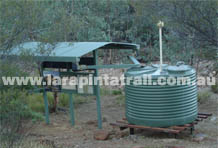
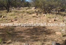
The trailhead at Hugh Gorge. Other than the trailhead and watertank, there is no other infrastructure.
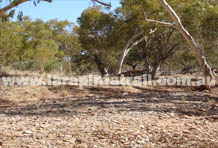
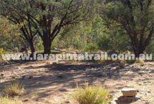
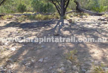
Some of the cleared areas for camping or vehicle parking. Walkers, as well as tour groups and the general pubic use this campground area. Some walkers choose to camp in the Hugh Gorge area instead of the open campgrounds shown here.
Another cleared area for camping or vehicle parking.
Some other cleared areas for camping or vehicle parking.

